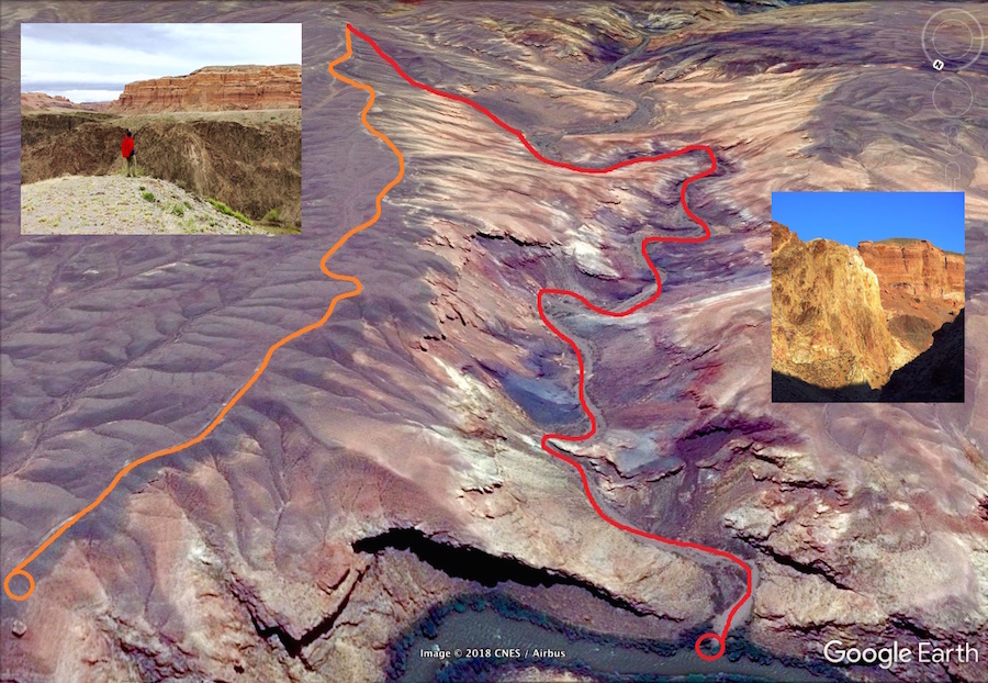
Location: lateral canyons of Charyn River, “Charyn canyons” National Park
Hiking distance/type:
- main option, red line: by the canyon - return trip (same way down/up the canyon), 3840m (3.8km) one way. Clay/crushed stone.
- additional option, orange line: to the view point, by the plateau. Ground trail, no height difference.
Lowest point: 914m ASL
Highest point: 1075m ASL
Season: March – November
More info can be found in Trekking Club free guide-book

