Home
слоган
[Home]     [рус]
+7 727 229 31 04
info@trekkingclub.kz
menu

10 best hikes around Almaty


10 most popular hikes around Almaty

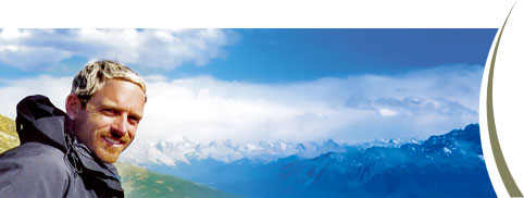
This guide contains descriptions of the best hiking trails around Almaty. The location of the city, its proximity to the Tien Shan mountains provides great opportunities to reach various natural spots in one day. We have selected the safest and most beautiful routes, which will help you exploring the variety of natural landscapes, from glaciers to deserts. We have also considered the logistics - so that all start/finish points could be reached by public transport, taxi or car (which can be rented). Most of the described trails are well equipped and marked. Nevertheless, please keep in mind season and weather ehwn plan your trip - choose appropriate clothes, boots and gear. 


Hiking over Kok Zhailau pass Hiking over Kok Zhailau pass map

Hiking over Kok Zhailau pass

route easy

↔ 14.3km    time 4-6 hours     ↑ 780m      ↓ 1000m   

Proximity to the city, stunning mountain views and wildlife makes this hike very popular among Almaty citizens...Read full description


Hike between Kolsai lakes Hike between Kolsai lakes map

Kolsai Lakes hike

route moderate

↔ 14.7km    time 5-6 hours     ↑ 450m      ↓ 470m   

Radial hike along the pictorial gorges of Kungey Alatau mountains.  Well-marked trail leads up from the first to the second Kolsai lake...Read full description


Touyuk-Su glacier hike Touyuk Su hiking map

Touyuk-Su glacier hike

route moderate

↔ 17,4km    time 6 hours     ↑ 1300m      ↓ 1300m   

Radial day glacier hike: having started from Almaty center, you will find yourself at a height of 3500m ASL within just few hours...Read full description


Kairak waterfall hiking Kairak waterfall hiking map

Kairak waterfall hike

route easy

↔ 16km    time 5-6 hours     ↑ 430m      ↓ 430m   

There are 8 kilometers in total from Batan (upper reaches of Turgen) to the waterfall, the path is wide and very comfortable...Read full description


Furmanov peak trek Furmanov peak trekking map

Furmanovka peak 

route moderate

↔ 16km    time 7-9 hours     ↑ 1360m      ↓ 1360m   

Furmanovka (Furmanov) is a trekking peak with the height of 3037 meters. Its top in the form of a regular triangle crowns the Kim-Asar gorge...Read full description


Terra glade hiking Terra glade hiking map

Trek to Terra glade from Prokhodnoye gorge

route easy

↔ 12km    time 3-4 hours     ↑ 800m      ↓ 800m   

Prokhodnoye gorge is the left tributary of the Big Almaty river. Route to Terra glade starts at the road leading to the Almarasan sanatorium...Read full description


Bogdanovich glacier hike Bogdanovich glacier hiking map

Bogdanovich glacier hike

route moderate

↔ 13km    time 4-6 hours     ↑ 400m      ↓ 400m   

The highest route on our list. The trail starts at Talgar Pass (3200m), which you can reach with a cable car from Medeo...Read full description


Gorelnik waterfalls hike Gorelnik waterfalls hiking map

Gorelnik waterfalls trek

route easy

↔ 7,2km    time 3,5 - 5 hours     ↑ 650m      ↓ 650m   

The route starts near the forester's house located at the entrance to the gorge. It stands next to the road leading to the Shymbulak ski resort...Read full description


Bukreyev peak trekking Bukreyev peak trekking map

Trek to Bukreyev peak over Lesnoy pass

route moderate

↔ 16km    time 6-8 hours     ↑ 1200m      ↓ 1200m   

It makes sense to reach the top of Bukreyev peak from the Butakovka Gorge. The route starts on the parking....Read full description


Butakovsky waterfall Butakovsky waterfall hiking map

Butakovsky waterfall hike

route easy 

↔ 5km    time 2.5 - 3 hours     ↑ 370m      ↓ 370m   

This route is perhaps the shortest one on our list. Nevertheless, the hike is intense and goes thru the beautiful landscapes of Butakovka gorge...Read full description


...AND ONE MORE PERFECT DAY HIKING OPTION: ALONG THE "JAPANESE TRAIL":


Site search


Social pages
Вконтактеvk.com
Instagraminstagram.com
info@trekkingclub.kz +7 727 229 31 04